

Summary: Indoors, underground parking garages, tunnels, and FPV drone race courses — GPS can fail everywhere. OpenVINS fuses information from a standard camera and an IMU to continuously output the device’s trajectory and attitude. It does more than run datasets: it turns hardcore pieces like multi-camera support, calibration, evaluation, and simulation into a reusable open-source platform.
In ground navigation, we are used to “opening a map and knowing where we are.” But robots, drones, and AR devices often face a different environment: no stable satellite signal, and surroundings changing rapidly.
In that case, how does a device know how far it has traveled, how much it has turned, and where to go next?
Today we recommend OpenVINS, an open-source visual-inertial navigation platform. It lets the camera handle “seeing,” lets the IMU “feel motion,” and fuses both streams into a continuous 6-DoF pose: position + orientation.
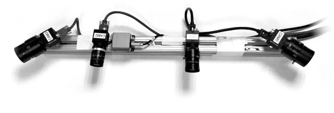
Multi-camera and IMU experimental rig from the OpenVINS official docs.
It Solves More Than “Recognizing the Scene”
Many people first encounter vision algorithms by understanding them as “recognizing objects in frames.” VIO (Visual-Inertial Odometry) cares more about: how the device itself is moving.
OpenVINS’s logic can be summed up in one sentence:
The camera captures stable features from successive frames, the IMU records acceleration and angular velocity at high frequency, and a filter fuses the two to estimate the trajectory in real time.
Its core uses an extended Kalman filter with the MSCKF sliding-window approach — it does not need to keep every feature point in the state vector long-term, making it well suited for real-time visual-inertial estimation. For developers, the most valuable part is that this is not just a demo showing results: it is a research and engineering foundation where you can read the code, swap sensors, change configurations, and run comparison experiments.
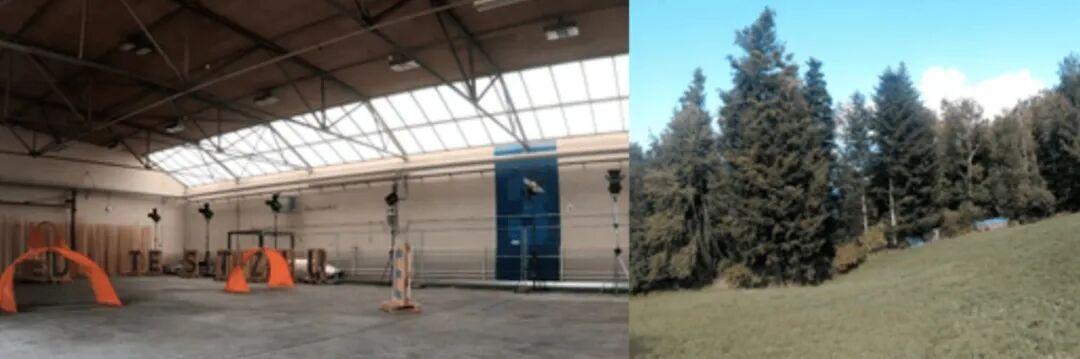
UZH-FPV dataset scenes from the official docs: indoor racing courses and outdoor high-speed flight.
Why Save This? 4 Capabilities You Can Actually Use
1. One framework, many camera configurations
Monocular, synchronized stereo, and dual cameras can all be integrated; feature tracking supports both KLT and descriptor-based approaches. When prototyping robots, drones, or spatial computing, you do not have to build a sensor-fusion pipeline from scratch.
2. The “calibration failure” pitfalls are addressed
What visual-inertial systems fear most is usually not that the algorithm is not cool enough, but that the camera and IMU are misaligned. OpenVINS supports calibration of camera-to-IMU extrinsics, temporal offset, camera intrinsics, and inertial device intrinsics — putting those invisible trajectory-killing problems on the table.
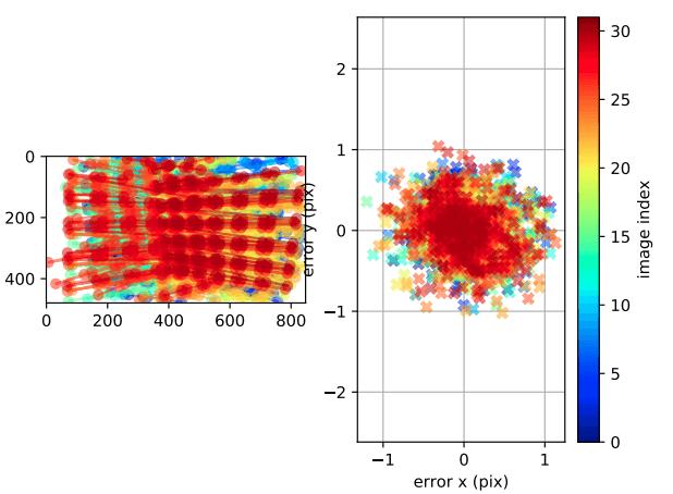
Reprojection error visualization from the OpenVINS official docs.
3. From static start to stable tracking in motion
It supports both static initialization and dynamic initialization; when the vehicle or device pauses briefly, zero-velocity updates can suppress error accumulation. For real devices, these “detail capabilities” often matter more than a beautiful algorithm formula.
4. Not just runnable — evaluable and reproducible
OpenVINS provides a simulator and evaluation pipeline covering common datasets like EuRoC MAV, TUM-VI, UZH-FPV, and KAIST Urban, with metrics such as ATE, RPE, NEES, and RMSE to check results. Comparing different parameters, sensor configurations, or algorithm branches does not have to be guesswork.
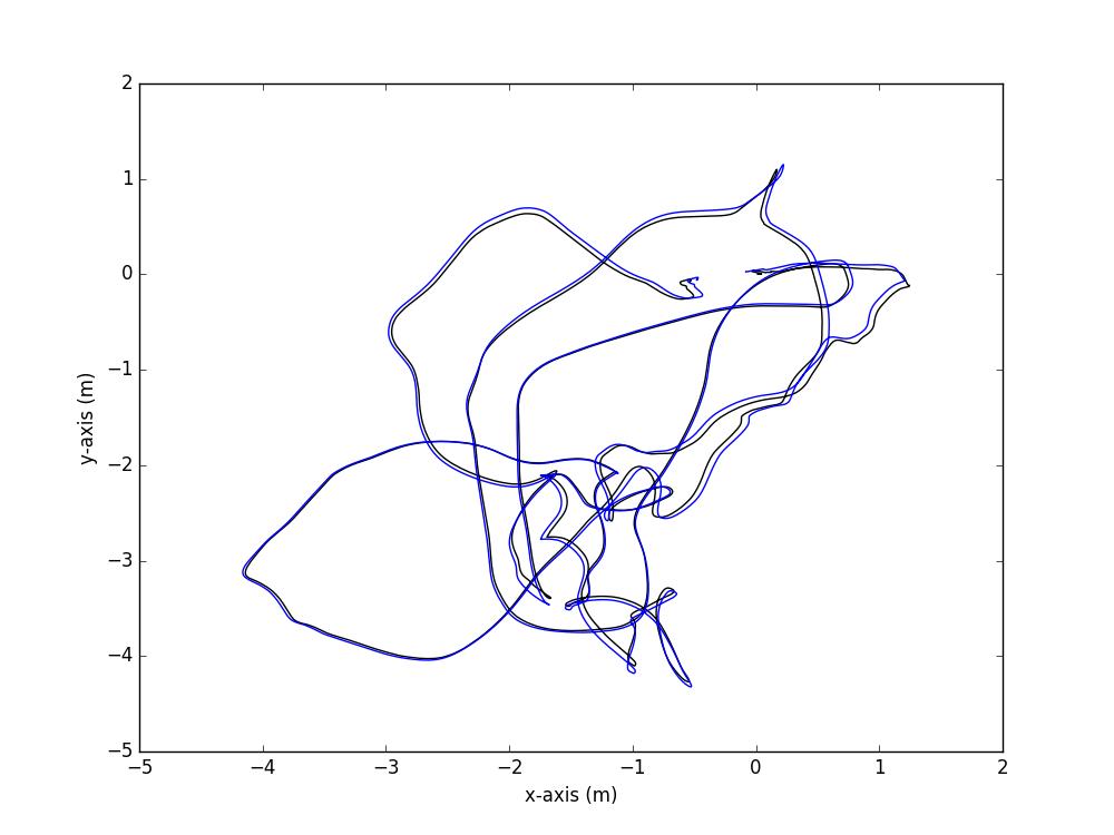
Estimated vs. reference trajectory comparison in the official OpenVINS evaluation.
Who Should Pick It Up?
- Developers building localization modules for drones, mobile robots, unmanned vehicles, or embodied AI.
- Students and researchers studying visual SLAM, VIO, or sensor fusion who want a reproducible experimental platform.
- Product and algorithm folks working on AR/VR, action cameras, or spatial computing prototypes who need to understand “where device pose comes from.”
- Tech enthusiasts who want hands-on practice with datasets rather than only reading papers and demo videos.
To be clear: VIO outputs continuous local relative poses, which do not natively equal the latitude/longitude on a phone map. Long runs still accumulate drift; if the business needs absolute coordinates, global navigation, or map consistency after loop closure, it must be combined with GNSS, maps, loop closure, or other systems. This is not a weakness of OpenVINS — it is lesson one in understanding the boundaries of visual-inertial localization.
Beginners: Don’t Rush to Real Hardware — Follow These 3 Steps
Step 1: Read the official Getting Started first. OpenVINS supports ROS 1, ROS 2, and ROS-free workflows. Pick one chain for your environment and do not mix configurations from the start.
Step 2: Run public datasets first. Get results working on mature data like EuRoC MAV or TUM-VI, confirm sensor timestamps, config files, and trajectory output are all correct, then switch to your own device.
Step 3: Handle hardware calibration. The mounting position of the camera and IMU, time synchronization, and intrinsics/extrinsics all affect results. Building calibration and error evaluation into the workflow is usually more effective than blindly tuning parameters.
Final Thoughts
The most attractive thing about OpenVINS is not just “camera + IMU can localize” — it is that the easiest parts of visual-inertial navigation to get wrong are all open here: multi-sensor support, initialization, calibration, simulation, dataset evaluation, and code implementation, all traceable.
If you are looking for a VIO open-source project that can go from theory to real testing, from datasets to real devices, it deserves a place in your bookmarks.
Project link: https://github.com/rpng/open_vins
If you have any questions about this topic, feel free to contact us at [email protected]
Have questions about this article? Feel free to contact us at [email protected] — we’re happy to help!
